7.5 miles
4 hours
Mam Tor is one of the iconic features of the Peak District. In terms of views attained for minimal effort the “Mother Hill” has few equals. At 517 metres it’s no minnow but most people start from the National Trust car park just off the Chapel-en-le-Frith to Castleton road and hence have to gain less than 100 metres to reach the summit. The hill has an interesting history having been used as a fortress in both the Bronze and Iron ages, and, on reaching the summit, the breathtaking views in all directions show what a sound defensive position it would have been. More recently there was the landslip in 1974 which led to the Stockport to Sheffield road being closed for good in 1979. The instability of the slopes have given name to another nickname bestowed upon the hill that of the “Shivering Mountain”. It’s a favourite spot with paragliders who can frequently be seen soaring on the thermals above the Hope and Edale valleys.
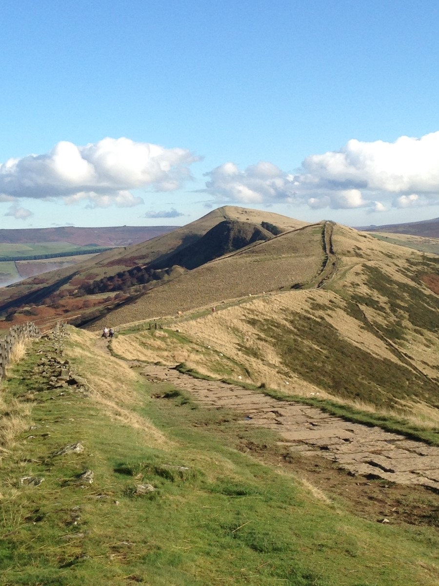
The climb up to the summit is a short one and as I reach the top the valleys of Edale and Hope spread out in front of me flanking the magnificent spectacle of the Great Ridge. The sun is shining on Edale and casting shadows over the slopes of Kinder but Castleton lies buried beneath a blanket of inverted cloud, only the enormous chimney of Hope Cement works penetrates the dense sea of white. The route ahead is clear, I follow the meander of the ridge towards the footpath junction at Hollins Cross, as I do so, the cloud starts to lift and Castleton is gradually revealed to me. A short, rocky slope leads me to the summit of Back Tor with its iconic lone tree and I stop for refreshment looking across to the darker clouds starting to move across the Kinder Plateau. The ridge continues gently up to end on Lose Hill allegedly named for the ancient King of Wessex, Cuicholm, who’s men are said to have been vanquished here in battle.
Reluctantly leaving the ridge and the views behind I follow the steep, grassy path down and eventually come to the village of Hope where I emerge opposite the church of St. Peter. After a short stroll along the road I turn right and cut through the grounds of the former Lose Hill Hall, once a Gothic mansion, now a flagship Youth Hostel and well worth a visit. As I start to head into Castleton, Mam Tor looms above me once more and after passing through farmland I emerge at the bottom of the road destroyed by the notorious landslip and opposite the Tolkeinesque-ly named Odin’s Mine. Now long abandoned it is thought to be one of the country’s oldest lead mines possibly dating back to Roman times. It’s a steep climb over the buckled and broken tarmac and the destructive force of the landslip is clear to see as I ascend eventually passing the Blue John cavern and from there making my way back to my car and a final glimpse of the “Mother Mountain” as I drive away.
I very much hope that you enjoy reading about my walks as much as I enjoy undertaking them. If you have any questions or enquiries about either my articles or guided walking in the UK please feel free to visit my webpage at www.comewalkwithmeuk.co.uk or e-mail me at Ian@comewalkwithmeuk.co.uk . Liking my facebook page or following me on twitter @cwwmuk will help you keep up to date with all my latest walks and general outdoor news. In the meantime, enjoy the ramblings of a rambler…